by max turner
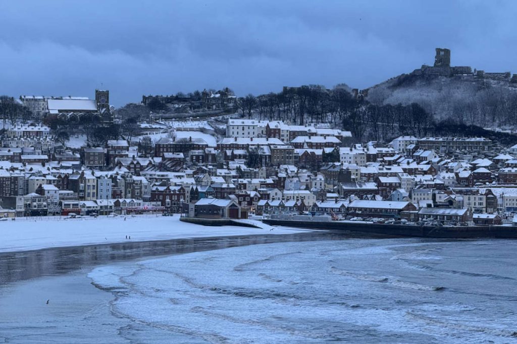
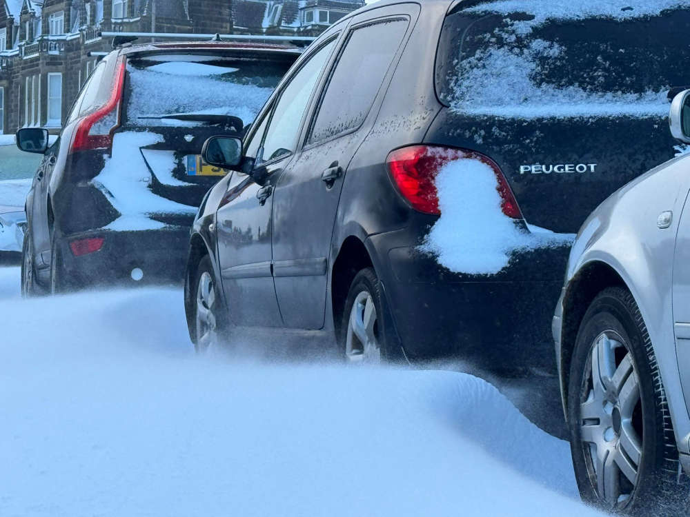
The Yorkshire Coast continues to see heavy snow with strong winds causing drifting and blocking roads.
The A165 between Scarborough and Bridlington and Brandesburton to Bridlington are badly affected, along with the A64 between Scarborough and Staxton. The A169 near Whitby is trechearous this morning, as is the A171 between Whitby and Ugthorpe.
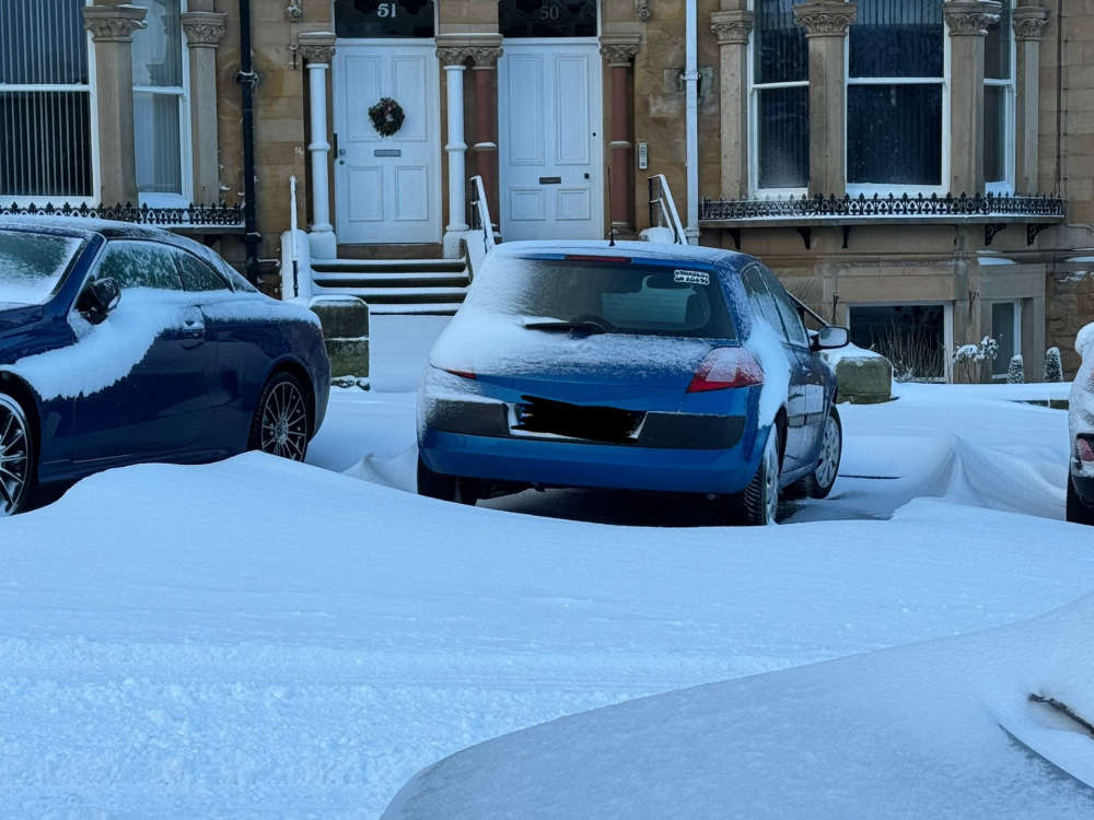
Swirling snow has been settling on the sides of buildings and drifting.
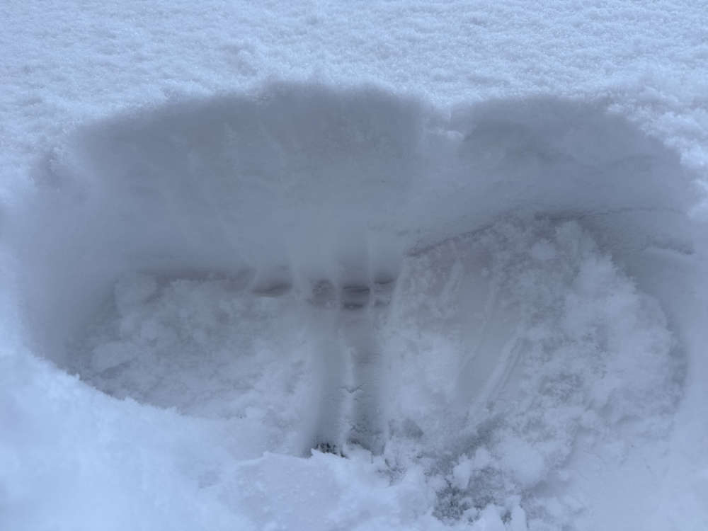
These children were having fun on The Esplanade:
There has been little let-up in the snow since early this morning with more ‘Streamers’ likely to form. These are when showers merge into lines of snow, giving great accumulations locally, whilst delivering very little just down the road.
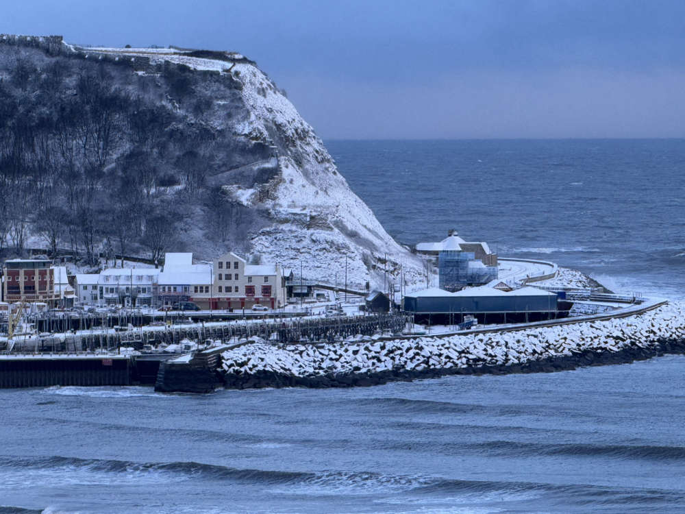
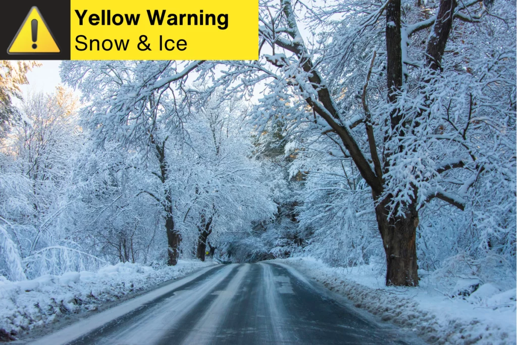
The Yorkshire Coast has been in the firing line this morning and a Yellow Weather Warning for snow and ice is in force until midnight.
Some train services between Bridlington and Scarborough have been cancelled.
The cold snap is likely to continue well into next week.
news in Scarborough
11 30
Scarborough theatre company
Last year, Scarborough theatre company performed the Wizard of OZ, and the next performances, school choirs can volunteer. If your school would like to volunteer, please contact scarboroughtheatrecompany@gmail.com or phone 07958 423420s
Sunday 4th January 2026,
Frequent heavy snow showers, moving in from the Yorkshire Coast, is bringing disruption to travel, with the Met Office updating warnings.
Snow began falling in Scarborough and Whitby on Friday afternoon with the A169, A171 and A174 around Whitby proving treacherous.
The Esk Valley has been hit hard, with the North York Moors expected to get the heaviest snowfall.
The Met Office released the following statement:
‘Snow showers are expected to spread further inland in the early hours of Saturday, becoming frequent and perhaps heavy at times.
‘Around 1-3 cm of snow is likely to accumulate quite widely, with 5-8 cm possible in places, this most likely across the North York Moors.
‘The snow showers will gradually become lighter and less frequent during Saturday evening, and move offshore overnight.
‘Icy patches will also form, particularly during Saturday evening where roads have potentially been left wet from partially thawed snow during the daytime.’
They’ve now added Sunday for ice and Monday for snow and ice, to the warning, stating:
‘Ice is expected to affect untreated surfaces on Saturday night into Sunday morning. This is following snow showers on Saturday, with ice forming where snow has partially thawed and re-frozen.
‘Snow showers are expected to move inland from the North Sea in the early hours of Monday, becoming frequent and perhaps heavy at times, before easing by early afternoon. Around 1-3 cm of snow is likely to accumulate quite widely, with 5-8 cm possible in places, this most likely across the North York Moors. Icy patches are also likely to form.’
School Closures

YesterdayAiry Hill Primary SchoolWhitby- Closed1 hour agoBarrowcliff SchoolScarboroughConditions outside school treacherous with BLACK ICE
- OpenYesterdayBay Primary SchoolBridlington
- OpenYesterdayBempton Primary SchoolBempton
- Closed1 hour agoBoynton Primary SchoolBridlingtonElectrical fault means school closed today.
- OpenYesterdayBraeburn Primary and Nursery AcademyScarborough
- OpenMar 17 2022Bridlington Nursery SchoolBridlington
- Partial15 minutes agoBridlington SchoolBridlingtonOpening at 10:45am
- Closed45 minutes agoBrompton and Sawdon Community Primary SchoolScarboroughClosed due to ICE
- OpenYesterdayBrompton Hall SchoolScarborough
- OpenYesterdayBurlington Infant SchoolBridlington
- OpenYesterdayBurlington Junior SchoolBridlington
- OpenMar 17 2022Cambian Scarborough SchoolScarborough
- OpenYesterdayCastleton Primary SchoolWhitby
- Closed1 hour agoCayton Community Primary SchoolScarborough
- OpenMar 17 2022Childhaven Community Nursery SchoolScarborough
- OpenYesterdayDanby Church of England Voluntary Aided SchoolWhitby
- OpenYesterdayEast Ayton Community Primary SchoolScarborough
- OpenYesterdayEast Whitby Primary AcademyWhitby
- OpenYesterdayEgton Church of England Voluntary Aided Primary SchoolWhitby
- OpenYesterdayFiley AcademyFiley
- OpenMar 17 2022Filey Church of England Nursery and Infants AcademyFiley
- Closed1 hour agoFiley Junior SchoolFileyClosed due to ICE
- OpenYesterdayFlamborough CofE Primary SchoolBridlington
- Closed43 minutes agoFriarage Community Primary SchoolScarborough
- OpenYesterdayFyling Hall SchoolWhitby
- OpenYesterdayFylingdales Church of England Voluntary Controlled Primary SchoolWhitby
- OpenYesterdayGeorge Pindar SchoolScarborough
- OpenYesterdayGladstone Road Primary SchoolScarborough
- OpenYesterdayGlaisdale Primary SchoolWhitby
- OpenYesterdayGoathland Primary SchoolWhitby
- OpenYesterdayGraham SchoolScarborough
- OpenNov 20 2025Hackness Church of England Voluntary Controlled Primary SchoolScarborough
- OpenYesterdayHawsker Cum Stainsacre Church of England Voluntary Controlled Primary SchoolWhitby
- OpenYesterdayHeadlands SchoolBridlington
- OpenYesterdayHertford Vale C of E Primary School
- OpenMar 17 2022Hilderthorpe Primary SchoolBridlington
- Closed16 minutes agoHunmanby Primary SchoolFiley
- OpenMar 17 2022International Christian Language School for Functional EnglishWhitby
- OpenYesterdayLealholm Primary SchoolWhitby
- Closed28 minutes agoLindhead SchoolScarborough
- OpenYesterdayLythe Church of England Voluntary Controlled Primary SchoolWhitby
- OpenYesterdayMartongate Primary SchoolBridlington
- OpenMar 17 2022Moorland Waldorf SchoolWhitby
- OpenMar 17 2022New Pasture Lane Primary SchoolBridlington
- Closed56 minutes agoNewby and Scalby Primary SchoolScarboroughConditions hazardous outside school with ice
- Closed1 hour agoNorthstead Community Primary SchoolScarboroughClosed due to BLACK ICE on surrounding roads
- OpenYesterdayOakridge Community Primary SchoolSaltburn-by-the-Sea
- PartialYesterdayOur Lady and St Peter Catholic Primary School A Catholic Voluntary AcademyBridlingtonOpening at 10am on Wed 7th Jan
- Closed2 hours agoOverdale Community Primary SchoolScarboroughClosed due to BLACK ICE
- OpenYesterdayQuay AcademyBridlington
- OpenDec 14 2023Ruswarp Church of England Voluntary Controlled Primary SchoolWhitby
- OpenYesterdayScalby SchoolScarborough
- OpenMar 17 2022Scarborough CentralScarborough
- OpenMar 17 2022Scarborough CollegeScarborough
- OpenMar 17 2022Scarborough North Children’s CentreScarborough
- ClosedYesterdayScarborough Pupil Referral UnitScarboroughThe Scarborough Pupil Referral Service will be closed on Wed 7th Jan due to the weather conditions.
- OpenYesterdayScarborough Sixth Form CollegeScarborough
- OpenMar 17 2022Scarborough South Children’s CentreScarborough
- OpenJan 5 2026Scarborough TECScarborough
- OpenYesterdayScarborough University Technical CollegeScarborough
- OpenYesterdaySeamer and Irton Community Primary SchoolScarborough
- OpenYesterdaySleights Church of England Voluntary Controlled Primary SchoolWhitby
- Closed2 hours agoSnainton Church of England Voluntary Controlled Primary SchoolScarboroughClosed due to ice
- PartialYesterdaySpringhead SchoolScarboroughSpringhead Lady Edith’s site will remain closed on Wed Jan 7th. We plan to open the Barry’s Lane site if the weather doesn’t change.
- PartialYesterdaySt Augustine’s Catholic School – a Catholic voluntary academyScarboroughOpening at 10am on Wed 7th Jan
- PartialYesterdaySt George’s Catholic Primary School – a Catholic voluntary academyScarboroughOpening at 10am on Wed 7th Jan
- OpenNov 20 2025St Hedda’s Catholic Primary School, a Catholic Voluntary AcademyWhitby
- Closed58 minutes agoSt Martin’s Church of England Voluntary Aided Primary School, ScarboroughScarborough
- PartialYesterdaySt Peter’s Catholic Primary School – a Catholic voluntary academyScarboroughOpening at 10am on Wed 7th Jan
- OpenMar 17 2022Staithes, Seton Community Primary SchoolSaltburn-by-the-Sea
- OpenMar 17 2022Stakesby Primary AcademyWhitby
- OpenMar 17 2022Sure Start Children’s Centre Bridlington OneBridlington
- OpenMar 17 2022Sure Start Children’s Centre Bridlington TwoBridlington
- Closed25 minutes agoThe Woodlands AcademyScarborough
- OpenYesterdayThomas Hinderwell Primary AcademyScarborough
- OpenNov 20 2025Welburn HallKirbymoorside
- OpenYesterdayWest Cliff Primary SchoolWhitby
- Closed1 hour agoWheatcroft Community Primary SchoolScarboroughIcey conditions around school
- OpenMar 17 2022Whitby & the Moors Children’s CentreWhitby
- OpenYesterdayWhitby SchoolWhitby
- Closed1 hour agoWold Newton Foundation SchoolDriffieldClosed due to ICE
- OpenMar 17 2022Wykeham Church of England Voluntary Controlled Primary SchoolScarborough
Search
Follow Us
Get Our Apps
Our Apps are now available for iOS, Android and Smart Speakers.


Today’s Weather
 ScarboroughSunny intervalsHigh: 5°C | Low: 1°C
- FileySunny intervalsHigh: 5°C | Low: 1°C
- WhitbySunny intervalsHigh: 5°C | Low: 1°C
- BridlingtonSunny intervalsHigh: 5°C | Low: 1°C
- HornseaSunny intervalsHigh: 5°C | Low: 1°C
- DriffieldSunny intervalsHigh: 4°C | Low: 0°C
News
- Withernsea Shoreline Searches Continue for Grace as More Details of Tragedy RevealedExtensive searches continue along the Withernsea shoreline as the search for a teenager missing in the sea since Friday continues.
- Further Ice Warning for Yorkshire Coast Brings More School ChangesResidents along the Yorkshire Coast and the broader Yorkshire and Humber region have been advised to prepare for icy conditions tonight as the Met Office issues a yellow weather warning.
- Spend Second Homes Premium on Local People says Filey MPFiley’s MP is calling for the funds raised from the council tax premium on second homes to be spent on providing affordable homes in the local area.